
Invert is a geophysical service provider for exploration of the upper crust
We combine passive seismic and electrical methods for the investigation of the upper crust to identify and quantify available geo-resources such as geothermal reservoirs, ore deposits, groundwater aquifers, and potential underground geo-storage.
We handle the survey from network design and deployment to quality controls and 3D depth inversion.
We support the energy transition with fast, reliable and economically affordable innovative methods.
Our Multiphysics and Multiscale approach
We offer the possibility to acquire two complementary datasets over your survey area - both fully 3D and nodal.
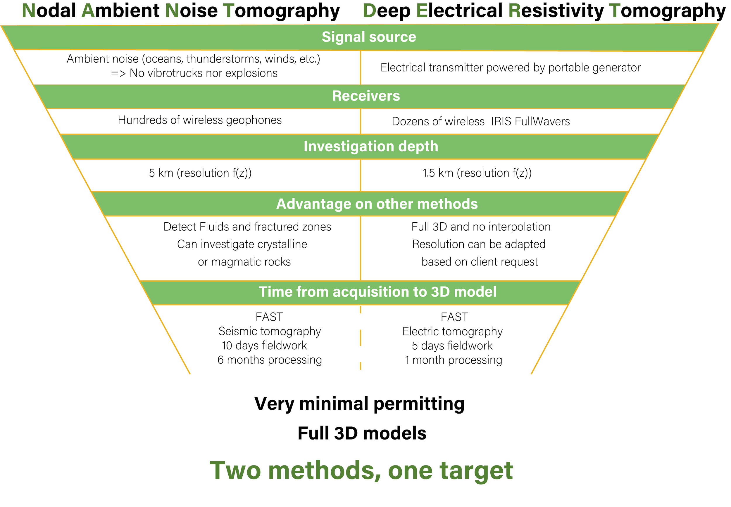
The benefits of combining two distinct geophysical methods into one approach are endless. By combining NANT (Nodal Ambient Noise Tomography) and DERT (Deep Electrical Resistivity Tomography), we revolutionize the way prospection is conducted. This multiphysics and multiscale strategy enhances penetration depth and resolution, significantly reduces exploration costs, and delivers a full 3D inversion in record time - all made thanks to our nodal receivers and streamlined workflow.
NANT: provides images to a depth of 5 km with a resolution of 300 meters.
DERT: offers higher spatial resolution, down to 10 meters cells, within the first kilometer.
With no need for induced seismic source or heavy cables, this solution is ideal for exploration in urban environments or the most remote locations.
By coupling these methods, you benefit from the strengths of both techniques, greatly enhancing your ability to delineate targets and advance your exploration projects with confidence.
Instruments
We count on hundreds of 3-C SmartSolo seismic nodes and dozens of IRIS FullWavers. This large amount of sensors allows high adaptability to the site geometry and client’s requests for resolution and depth of investigation. We conduct resolution tests before each campaign and test several networks design to maxmize data quality and retrieve the clearest image of the subsurface.


Let’s Work Together
We’re excited to explore new opportunities and bring our expertise to projects worldwide. Reach out to us, and one of our project managers will promptly guide you through the proposal process.