
Deep Electrical Resistivity Tomography (DERT)
Electrical Resistivity Tomography is a well-established geophysical exploration method.
We improve its current penetration depth by using networks of IRIS FullWavers receivers, that allow us to investigate in ideal conditions up to 1.5 km with a high degree of lateral resolution.
Our receivers feature adjustable dipole spacing ranging from 1 to 50 meters. They are battery-operated, GPS-synchronized, and quasi cable-less, allowing deployment even in complex field conditions.
DERT is fully 3D thanks to the flexibility of the receivers, eliminating the need for interpolation between standard 2D lines.
Non-invasive measurement campaigns often go unnoticed by locals, helping with a high social acceptance.
We invert for resistivity and chargeability (IP). DERT is complementary to NANT as it provides information on polarizable and conductive bodies and increase knowledege of the first kilometer below surface.
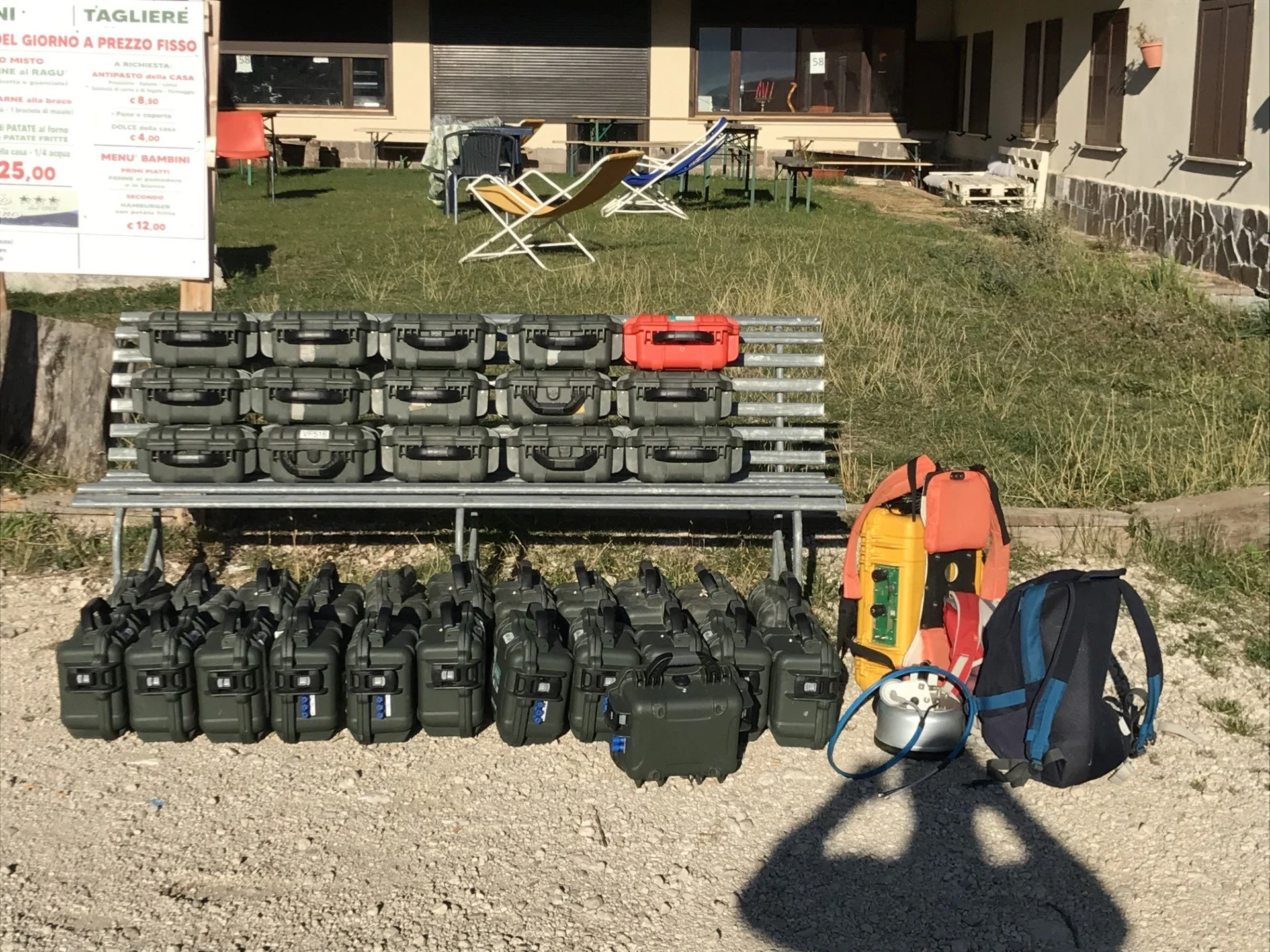
We have access to dozens of FullWavers receivers, probably the largest pool in Europe. This grants accurate and high-resolution resistivity inversion that pushes the resolution and investigation depth beyond the current limts.
Deep Electrical Resistivity Tomography is an ideal tool for geothermal exploration. It allows us to directly image conductive regions enriched in fluids, such as aquifers, which can be harnessed for heat production.
If your project targets a specific fault system that channels hot fluids or can be engineered in this way, we can detect it by identifying lithological contrasts created by the fault itself or by pinpointing zones where the fault facilitates the circulation of fluids through the crust.
We adapt our survey to all scales, from the development of geothermal power plants to the research of water or heat sources for private customers.
Conventional ERT is widely used in mineral exploration, but often runs up against limitations in the field or fails to investigate deeper structures. Our advanced approach delivers 3D resistivity and IP models down to 1.5 kilometers, supported by a flexible acquisition network that adapts seamlessly to any topography or inhabited area.
Case studies
DERT performed at the GEO-01 well at Geneva airport. The conductive layer shows an artesian aquifer characterised by fluid temperatures of about 34°C (at approx. 700 m depth).

The conceptual model above was derived independently from the geophysical acquisition by M. Koumrouyan at the University of Neuchatel, Switzerland. Note how the conductive domains nicely fits the aquifer hosted in the Malm carbonates.
Image taken from Koumrouyan (2019). GEOMECHANICAL CHARACTERISATION OF GEOTHERMAL EXPLORATION BOREHOLE: IMPLICATION FOR THE GEO-01 WELL, IN GENEVA
Calamita Fe-skarn deposit was investigated with DERT to better constrain structural geology and factors driving mineralization.